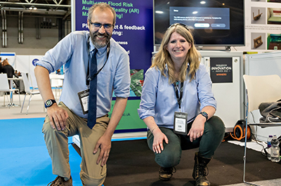
An augmented reality flood risk model, developed by leading environmental consultancy GeoSmart Information with academics at Liverpool John Moores University (LJMU), has been recognised by leading experts for its exciting potential.
The application has won an Excellence in Innovation award at this year's Flood Expo, Europe's leading flood management event that took place at the Birmingham NEC. It was one of just four projects selected for the prestigious award.
Dr Ian Walkington, research manager at Shropshire-based GeoSmart Information, which is a UK leader in producing proprietary flood data, has been working with Dr Sarah Percival, senior lecturer in geography (coastal resilience) within the university's School of Biological and Environmental Sciences. Together, they have studied the potential benefits of interactive 3D visualisations in communication of flood risk to a range of audiences.
Dr Walkington, a former senior lecturer at LJMU, was a colleague of Dr Percival for about four years and they have been working together for the past year on flood visualisation, trialling and evaluating the effectiveness of GeoSmart's flood risk visualisation techniques and approaches.
The work has now been recognised by flood management experts for its innovation and for the positive impact it will have in the flood risk sector.
Dr Walkington, who has more than 20 years' experience of working in fluid dynamics and computer modelling, said: "To have been recognised and awarded by Flood Expo demonstrates the potential this application could have on communicating flood information and increasing understanding of risk," he said.
"Working with LMJU on projects such as these is hugely beneficial for us as we can expand our research funding reach by working with the university and also help shape its research direction, while the university benefits from having industry links for its research applications together with our expertise in flood data.
"We are planning to continue our collaboration and are applying for external research funding to enable us to further the work we have already completed.
"The work will involve undergraduate and postgraduate students, to help develop their understanding of flood risk and resilience in the community and how visualisation can help in this process."
GeoSmart Information, which was established in 2013, has a strong technical base and a successful flood and environmental reports business that is used by commercial enterprises and in millions of domestic conveyances.
In November last year, it launched FloodSmart Analytics, a product that enables insurers, risk managers and mortgage lenders to accurately assess flood risk at even single building level. It provides high-definition analysis for flood depths, probabilities and the costs of flooding from river, coastal, surface water and groundwater sources, including climate change impacts.
GeoSmart’s data is already relied on by multiple sectors, from millions of home-owners to corporate entities and public sector operators, and the data have supported research by the Climate Change Committee (CCC), the UK’s independent adviser on tackling climate change. For more details, visit: https://geosmartinfo.co.uk
After demonstrating the application at Flood Expo, which attracts more than 2000 professionals from across civil engineering, local authorities, insurance and flood innovation sectors, Drs Walkington and Percival will use feedback from delegates to determine future updates within the project and to inform further scientific developments.


Latest News